
The Route
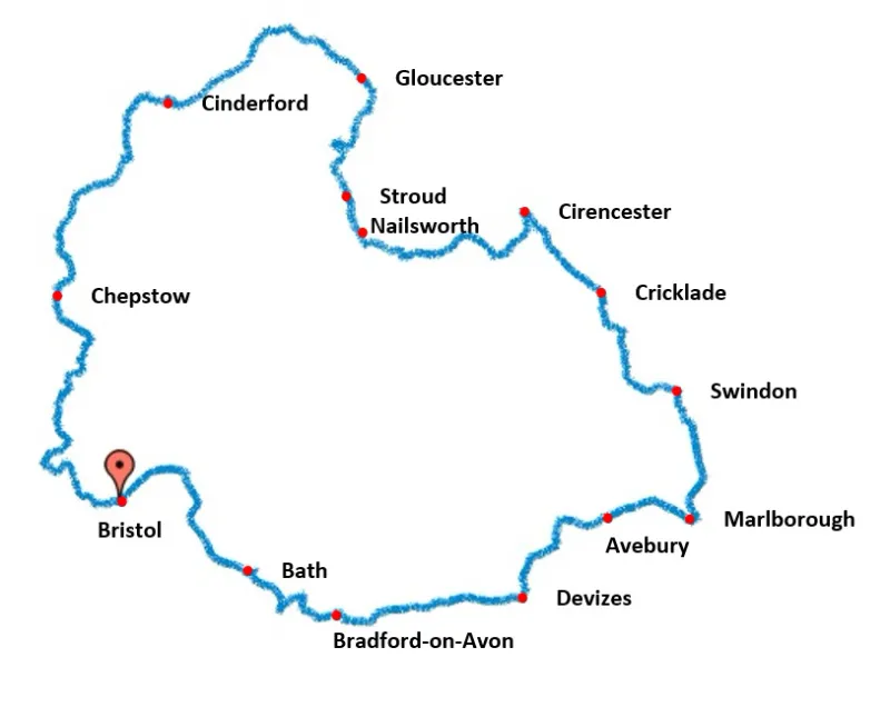
The circular route travels anticlockwise from Bristol. Starting at the iconic Bristol Temple Meads Railway Station (designed by IK Brunel), it reaches the towns and cities of Bath, Trowbridge, Devizes, Marlborough, Swindon, Cirencester, Nailsworth, Stroud, Gloucester, Cinderford and Chepstow, before crossing the River Severn and heading back into Bristol underneath the Clifton Suspension Bridge.
The route finishes at the museum ship SS Great Britain, the magnificent steamship designed by IK Brunel and launched on 19 July 1843.
Jump to a section
Bristol to Bath
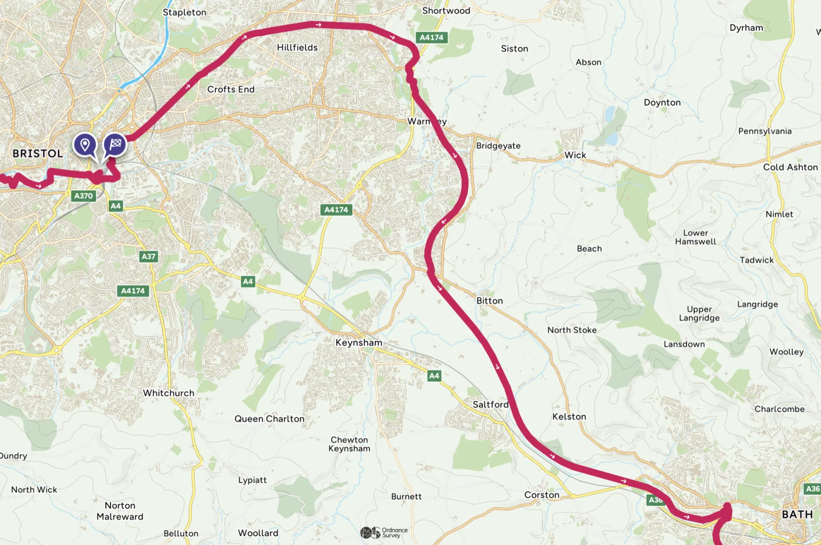
16 miles / 26 km
From Bristol Temple Meads Railway Station the route heads out of Bristol to Bath along the Bristol and Bath Railway Path, a dedicated cycle path on the disused railway line of the Midland Railway Mangotsfield and Bath branch line. The cycle path on this line was first launched by Cyclebag (later Sustrans) in 1978. After hundreds of volunteers put in hundreds of days of labour, the first 8 km were completed in the latter part of 1979. The whole line was completed in August 1985, 150 years after the opening of the original railway line.
This cycle path forms part of National Cycle Route 4, a route running from London to Fishguard, Pembrokeshire.
Bath to Bradford-on-Avon
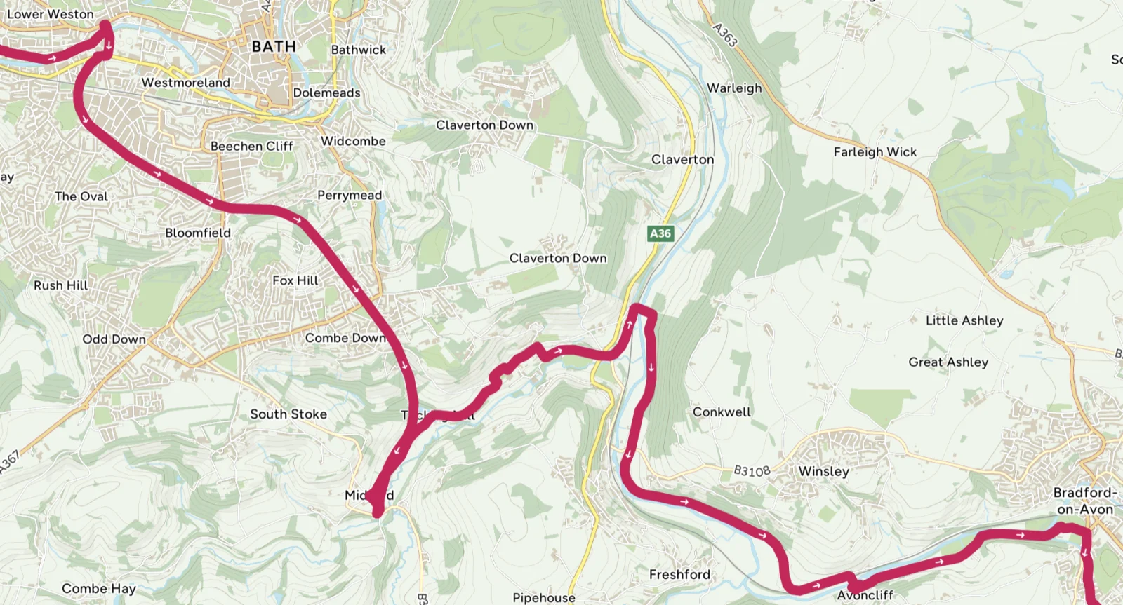
9 miles / 15 km
Starting in Bath, follow the Two Tunnels Greenway along National Cycle Route 244.
Leaving the city, the flat, well-maintained path leads you to the Devonshire Tunnel, a 400 m illuminated tunnel offering a cool, atmospheric ride.
Soon after, you'll enter the Combe Down Tunnel, the UK's longest cycling and walking tunnel at 1.03 miles (1.67 km). Well-lit and featuring ambient music, the gentle incline makes for a memorable stretch. Exiting the tunnel, you join National Cycle Route 24, known as the Colliers Way, and enjoy tranquil countryside views on a gradual descent towards the Dundas Aqueduct, a stunning 19th-century engineering marvel which carries the Kennet and Avon Canal over the River Avon. From here, the route follows the canal towpath, a flat, scenic path flanked by charming narrowboats, canal locks, and occasional wildlife. This final stretch leads you into Bradford-on-Avon, a historic town with cobbled streets, the striking Tithe Barn, and plenty of character to explore.
Mostly traffic-free, this ride offers a mix of tunnels, countryside and waterways, making it an unforgettable cycling experience.
Bradford-on-Avon to Devizes
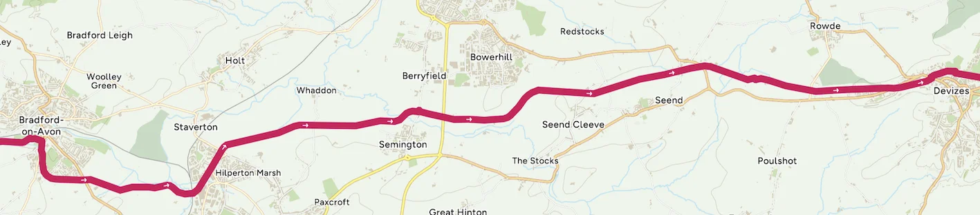
About 12 miles
Starting in Bradford-on-Avon, the route follows the Kennet and Avon Canal towpath eastward. The path is flat and well-maintained, ideal for cyclists of all levels. Leaving the picturesque town, you'll pass narrowboats moored along the canal and encounter charming lock systems and bridges that reflect the canal's rich history.
As you pedal through the serene Wiltshire countryside, you'll approach Avoncliff, where the canal crosses the Avoncliff Aqueduct. Pause here to admire the views of the River Avon below or visit a nearby café. Continuing along the towpath, the route meanders past peaceful rural landscapes and small villages.
Further along, you'll reach the Caen Hill Locks, a remarkable flight of 29 locks near Devizes, considered one of the most impressive engineering feats of the canal. The locks are a key highlight, and the adjacent path offers breathtaking views of the surrounding countryside.
The final stretch into Devizes is straightforward, with the towpath leading you directly to the bustling Wharf area, home to cafés, shops, and the Kennet and Avon Canal Museum, perfect for learning more about the canal's history. This section offers a mix of tranquillity, engineering marvels and natural beauty.
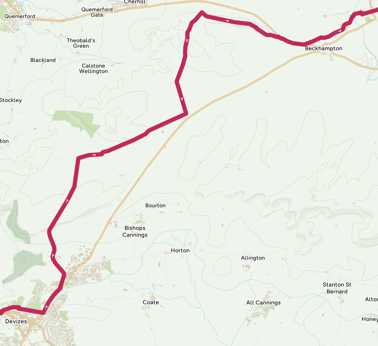
Devizes to Avebury
About 12 miles
Leaving Devizes, the route briefly follows the A361 before turning left onto Folly Lane. This road later leads to a quiet single-track road that forms part of the White Horse Trail. This tranquil lane leads to the Devizes White Horse, carved into the chalk hillside in 1999 to celebrate the millennium. Although modern, it echoes Wiltshire's long tradition of chalk figures, offering panoramic views of the surrounding countryside.
From here, the route continues on non-vehicular tracks to Roundway Hill, a prominent site with deep historical significance. It overlooks the battlefield of the Battle of Roundway Down (1643), a decisive clash during the English Civil War where Royalist forces triumphed over the Parliamentarians. The area is also a haven for wildlife, with skylarks often heard in the open skies above.
The trail winds onward to the Cherhill White Horse, one of the oldest chalk figures in Wiltshire, dating back to 1780. Nearby, you'll pass Oldbury Castle, an Iron Age hillfort with commanding views of the Vale of Pewsey.
Continuing along the Old Bath Road, part of the Wessex Ridgeway, the journey leads into Avebury, a UNESCO World Heritage Site. Here, you'll encounter the world's largest stone circle, steeped in Neolithic history, making a remarkable conclusion to this journey filled with scenic beauty and rich heritage.
Avebury to Marlborough
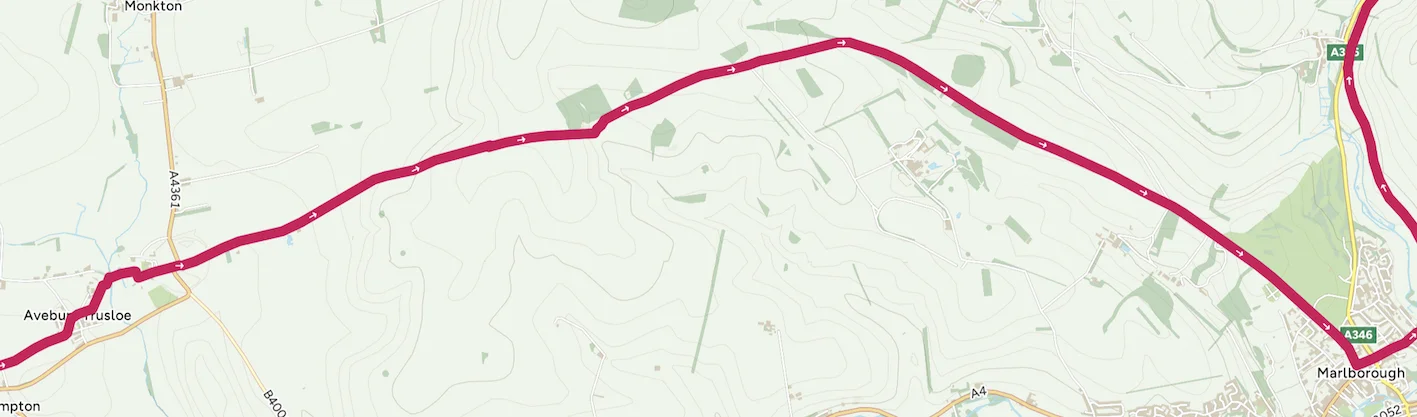
About 7 miles
From Avebury, follow the Wessex Ridgeway, which overlaps with the Herepath or "Green Street", an ancient Saxon military road. This route also forms part of National Cycle Route 403, ensuring a scenic and well-signed journey. The trail features compact tracks and grassy paths, suitable for cyclists with hybrid or off-road bikes.
As you ascend the ridgeway, the landscape opens into the North Wessex Downs, an Area of Outstanding Natural Beauty. The elevated path offers sweeping views of rolling hills and chalk downlands, dotted with prehistoric landmarks like barrows and earthworks. The peace and quiet of this ancient route is complemented by the sights of grazing sheep, red kites soaring overhead, and wildflowers lining the trail.
The descent into Marlborough is gentle, leading directly into this historic market town. Known for its unusually wide High Street, Marlborough offers a wealth of cafés, pubs and shops to explore. This route is a perfect blend of history, nature and rural charm.
Marlborough to Swindon
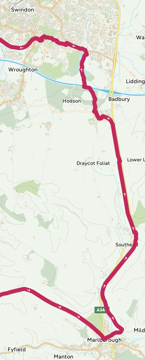
Leaving Marlborough, head north to join the Chiseldon and Marlborough Railway Path, part of National Cycle Route 482. This traffic-free path follows the route of the old railway line, offering a smooth, scenic ride through the rolling chalk landscapes of the North Wessex Downs.
As you cycle, you'll pass through Ogbourne St George, a charming village nestled in the downs. The path is flanked by open countryside, with occasional glimpses of grazing livestock and wildflowers. From here, continue towards Chiseldon, where the railway path briefly intersects with village roads. Take a small detour through Chiseldon to explore its quiet streets before rejoining the railway path.
The route then carries you over the M4 motorway, transitioning from rural tranquillity into the outskirts of Swindon. Your next stop is Coate Water Country Park, a lovely green space featuring a lake, wildlife and picnic spots. This is an ideal place to rest and enjoy the surroundings.
From Coate Water, a traffic-light route takes you to Swindon's Old Town, a historic area filled with boutique shops, cafés and pubs.
Swindon to Cirencester
16 miles / 26 km
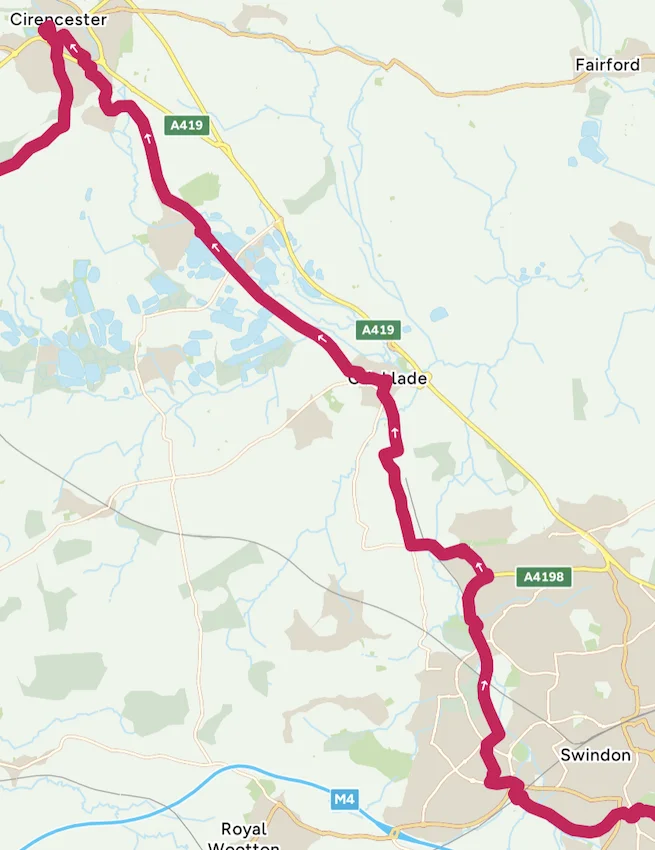
Starting in Swindon's Old Town, join National Cycle Network Route 45, which largely follows the route of the old GWR (Great Western Railway) railway line.
This dismantled railway provides a mostly traffic-free and well-maintained path, ideal for cycling out of the urban area and into the countryside. The first stretch to Cricklade traces a branch line of the GWR that once connected Swindon to Cirencester and beyond. Along the way, you may spot remnants of the railway's past, such as embankments, bridges and cuttings, providing a tangible link to the region's industrial heritage.
At Cricklade, a historic Saxon town known as the "First Town on the Thames", you can pause to explore its medieval church and quaint high street.
Continuing north on Route 45, the path meanders through tranquil countryside and leads to the South Cerney Lakes, part of the expansive Cotswold Water Park. This area is a haven for wildlife and outdoor activities, offering picturesque views of the lakes and wetlands.
As you approach Cirencester, the route guides you into this historic Roman market town, culminating at the old railway station, designed by Isambard Kingdom Brunel. Though no longer in use, the station stands as a testament to Brunel's brilliance and Cirencester's rich railway history.
Cirencester to Stroud
15 miles / 24 km
Leaving the Old Railway Station in Cirencester, follow National Cycle Route 45. The path crosses the disused railway line from Cirencester to Kemble and the Thames & Severn Canal, offering glimpses of the area's industrial heritage. Quiet country lanes lead you through the peaceful village of Kemble and the charming Cotswold hamlets of Tarlton and Rodmarton.
As you approach Avening, a short off-road trail takes you into this picturesque village, known for its historic church, St Mary's, and cosy pubs – perfect for a well-earned rest. Leaving Avening behind, the route transitions to off-road gravel trails with stunning views of Gatcombe Park, the private residence of Princess Anne, and the scenic valleys surrounding Nailsworth. This section's mix of open landscapes and wooded areas is ideal for gravel cycling enthusiasts.
Descending into Nailsworth, a vibrant town with numerous cafés, restaurants and shops, the route rejoins the path of the old Midland Railway line. Though the station at Nailsworth is now a private residence, a recently refurbished 5-mile section of the trail – crafted from recycled tyres – provides a smooth and eco-friendly cycling experience. Along the way, you'll find a pump track near Woodchester, perfect for a playful detour.
The section ends at the site of the old Dudbridge Railway Station, adjacent to a supermarket with a café for refreshments. Before entering Stroud, you'll pass evidence of another disused railway line leading toward Stroud Railway Station, another Brunel design.
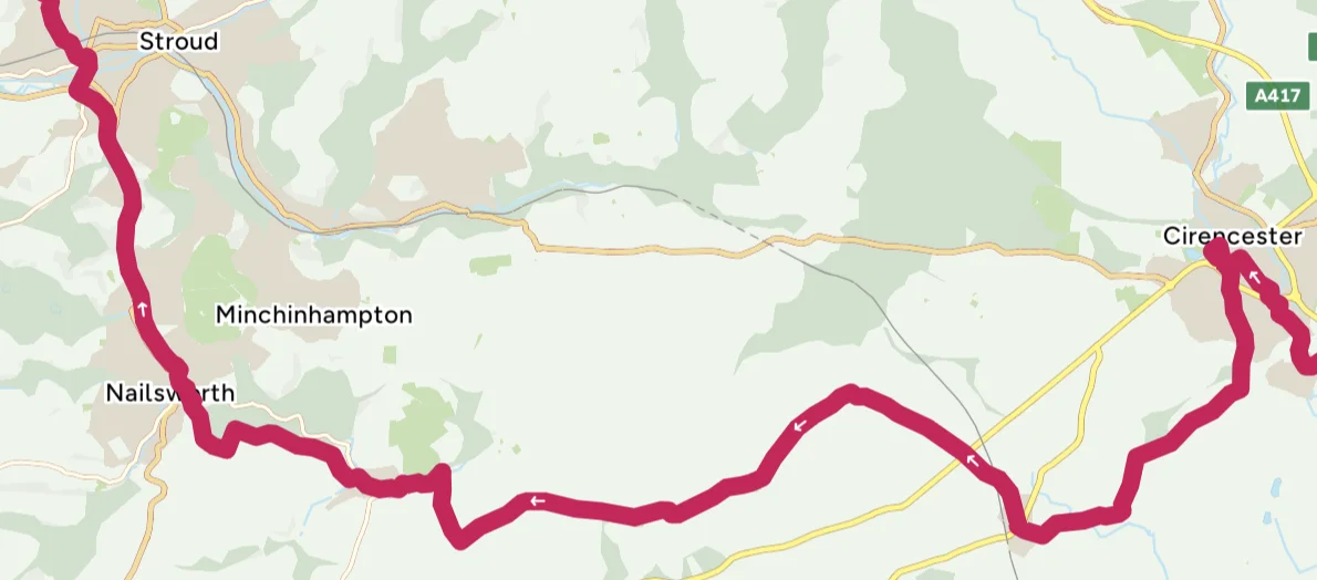
Stroud to Cinderford
About 30 miles
This scenic section begins with a climb out of Stroud to the tranquil Randwick Woods, offering a satisfying challenge for cyclists. The ascent rewards you with meandering paths through Randwick and Standish Woods, surrounded by lush greenery. Upon exiting, pause at the topograph point for stunning panoramic views across the River Severn and into the Forest of Dean. On clear days, you can see the iconic bridges linking England and Wales in the distance.
Continuing along the Cotswold Way, the route takes you through more wooded trails and into the village of Edge. A quick crossing onto a quiet road leads to another wooded cycleway, which eventually transitions into peaceful country lanes. These lanes wind through the Cotswold valley of Painswick, offering idyllic countryside views.
From here, the route heads to Gloucester Docks, following cycleways as much as possible. The vibrant docks area is rich with maritime heritage, a great place to pause and explore. Leaving the docks, cross the cycle-friendly bridge over the River Severn to Alney Island, a unique spot formed by the river's split and rejoining.
Crossing Over Bridge, designed by Thomas Telford in 1830, you join National Cycle Route 42 near the charming Over Farm Shop, a perfect stop for fresh local produce. The journey continues through quiet country lanes and cycleways past the villages of Rudford, Tibberton, Birdwood, Upper Ley, Northwood Green, Boseley, Flaxley and Littledean. Arriving in Cinderford, you're greeted by the gateway to the Forest of Dean, ready for your next adventure. This section combines woodland trails, quiet roads and historic landmarks, making it a diverse and rewarding cycling experience.
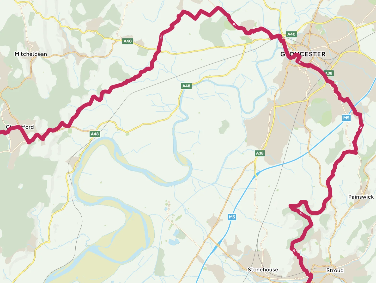
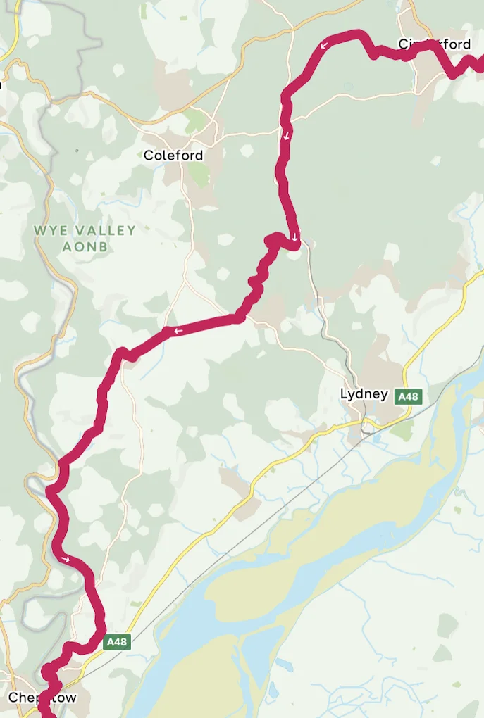
Cinderford to Chepstow
Leaving Cinderford, the journey continues along National Cycle Route 42, immersing you in the tranquil beauty of the Forest of Dean. Quickly joining the dismantled Severn and Wye Railway, the route takes you through shaded woodland trails, skirting past Parkend.
A short diversion follows the branch line from Parkend to Coleford before rejoining forest cycle trails. Exiting the forest, the route transitions to quiet country lanes, passing the historic village of St Briavels, known for its 12th-century castle, and descending to Brockweir along the River Wye. Brockweir offers a charming riverside setting, with nearby access to Tintern Old Station, where tea rooms in old railway carriages provide an ideal spot to rest and refuel.
From Brockweir, the journey follows the River Wye along a scenic cycle path, joining the disused Wye Valley Railway, now part of the Wye Valley Greenway. This stunning 5-mile stretch connects Tintern Abbey to Chepstow, featuring the Wireworks Bridge and the Tidenham Tunnel. Open from April to September, the tunnel is softly lit to protect the resident bat population. An alternative route is available when the tunnel is closed.
Continuing along the Wye Valley Greenway, the route ends at Chepstow. From here, cycle up Beachley Road, where the Chepstow Railway Bridge, originally designed by Isambard Kingdom Brunel in 1852, comes into view. Brunel's iconic cast-iron pillars still support the modern railway bridge, a testament to his engineering genius. Finally, cross the River Wye via Bridge Street, completing this picturesque and historically rich journey into Chepstow.
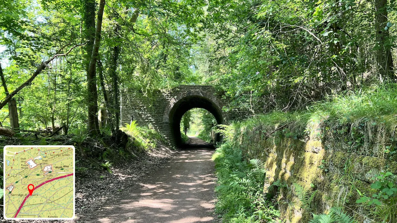
Severn & Wye Railway
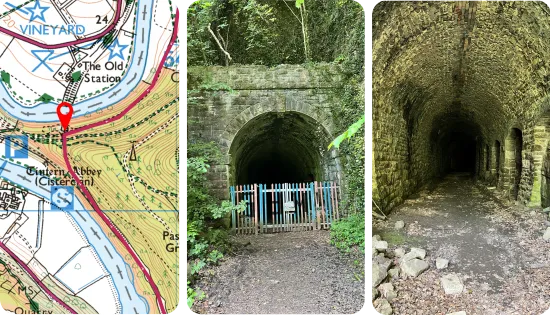
South portal
Swipe or scroll sideways for more photos →
Chepstow to Bristol
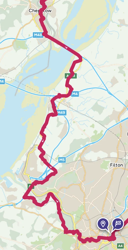
The final section of this journey follows National Cycle Routes 42 and 4 through Chepstow, crossing the River Severn via the iconic Severn Road Bridge. This thrilling segment offers sweeping views of the estuary before continuing to Severn Beach, just past the entrance to the Severn Tunnel, constructed by the Great Western Railway (GWR) between 1873 and 1886.
From Severn Beach, the route skirts the edge of Bristol through Avonmouth and Shirehampton, crossing the River Avon on the cycle path along the M5 bridge. This bridge provides remarkable views of the River Severn, framed by railways on either side of the water.
The journey continues to Pill, where the path joins the River Avon Trail, hugging the river all the way into Bristol and passing beneath the world-famous Clifton Suspension Bridge.
For those seeking a different perspective, an alternative route climbs alongside an old railway line through Oak Wood, leading into Leigh Woods and onto the Clifton Suspension Bridge. Designed by Isambard Kingdom Brunel and completed with improvements by William Barlow and John Hawkshaw, this engineering masterpiece offers spectacular views of the Avon Gorge.
Continuing under the suspension bridge, the route winds through Bristol, passing Brunel's Swing Bridge, relocated in 1873 from the South Entrance Lock to the North Entrance Lock, and concluding at the historic SS Great Britain. This magnificent ship, designed and built by Brunel and first launched on 19 July 1843, is now a museum ship.
The route officially finishes at the entrance to the SS Great Britain, but a further short journey ends at Temple Meads Railway Station, another Brunel-designed marvel and a fitting conclusion to this adventure through history, engineering and stunning landscapes.
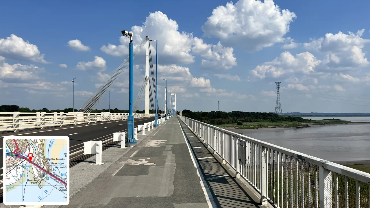
Looking south to Beachley
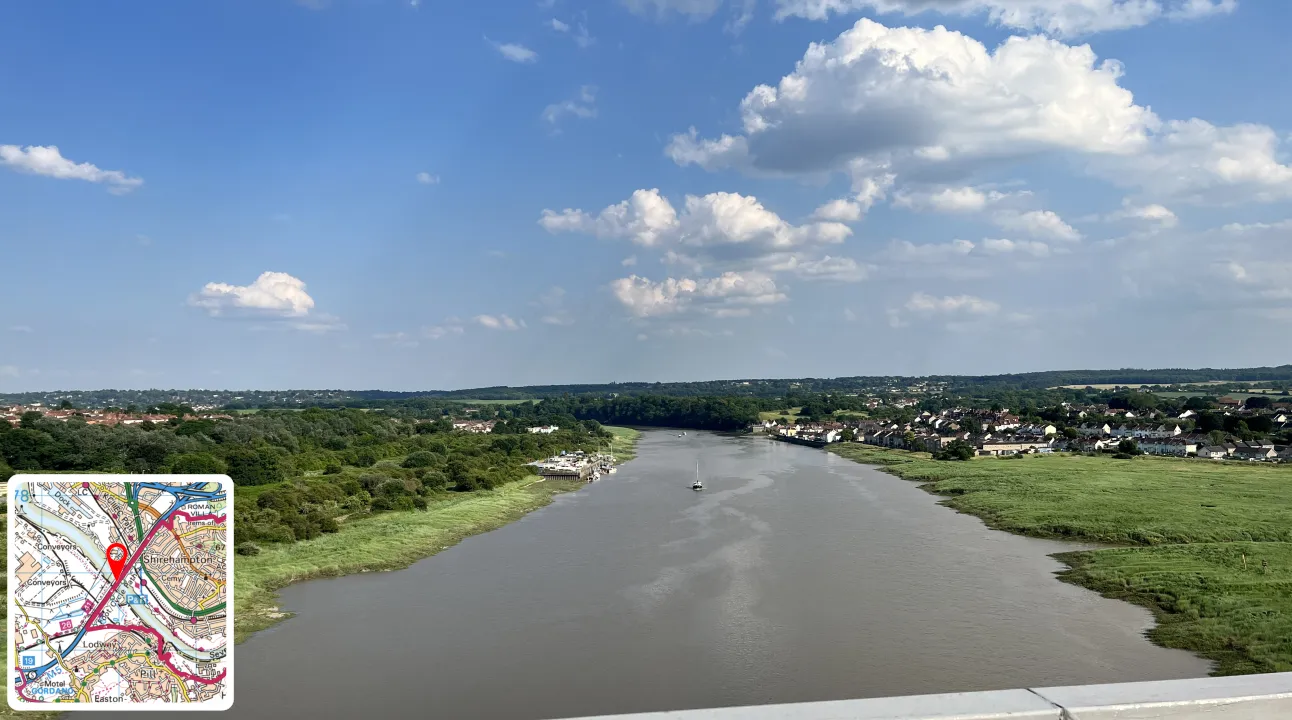
Looking towards Bristol
Swipe or scroll sideways for more photos →